I first heard of Chris Jedrzycki from his cycling stories posted on the Crazyguyonabike
site https://cgoab.com/Spoke2010 in which
he told of cycling challenging routes way off the beaten path. I got to meet him
in 2014 on my first ride to Kanchanaburi Province. He and his Thai wife Areeya run
Hidden Holiday House, a little guesthouse beside the Tha Chin River near the town
of Nakhon Chaisri, just a dayĺs ride west of Bangkok; the website
www.hiddenholidayhouse.com/index.php/en/homehhh-en-gb
has a description and even a cyclistĺs map of how to get here from Bangkok. I didnĺt
get to see them again until the end of my South Thailand ride in 2021, when Chris
told me that he leads informal kayak and bicycle tours. I rarely have the opportunity
to join group trips, and signed up for a kayak trip on a remote stretch of the Mae
Nam Ping River in January 2022, then a Ĺsoft-nutĺ bicycle tour in East Thailand
the following February. Now in January 2023 Iĺm back for another set of kayak and
cycle trips!
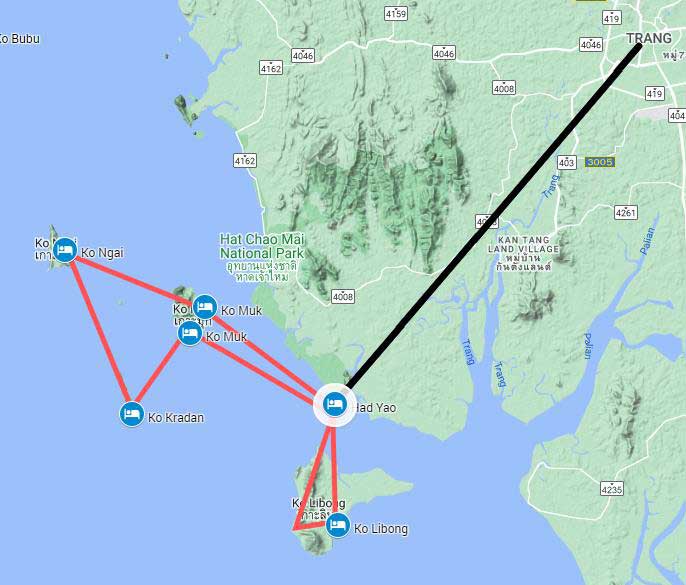
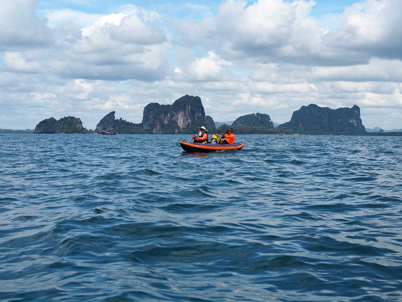
Chris designed this marvelous trip as an island-hopping experience on the Andaman Sea. The numerous islands make them ideal for kayaking with most of the crossings short and the longest at 6 kilometers. The sea is very calm December to February with warm temperatures and little chance of rainŚperfect kayaking conditions in paradise. We took in dramatic views of towering limestone pinnacle islands while paddling along the shores, open water, and verdant mangrove channels. We experienced ôliving islandsö with Muslim fishing villages and uninhabited ones. We strolled white-sand beaches and wandered through rugged hills on jungle trails. We even went kayaking through a couple caves, including spectacular Emerald (Morakot) Cave to a beach and jungle in a hidden ôlost world.ö On snorkeling stops we jumped in clear waters to join colorful fish, corals, and other sea life. And at the end of every day we could look forward to relaxing in a comfortable resort or home stay and go out for a tasty meal at a restaurant. On Facebook, Chris set up a Trang Kayak group so that we could exchange notes and photos during the trip; surprisingly we had cell coverage most of the time.
Our route first made a three-day clock-wise loop south from Had Yao Beach to Ko Libong, then a six-day clockwise loop west from Had Yao Beach to Ko Muk, Ko Kradan, Ko Ngai, Ko Muk again, and back to Had Yao Beach. We also visited small islands near Ko Ngai not shown here and paddled Lat Chao Channel, a long section of mangrove channels north of Had Yao Beach. The black line represents the car transfer from Trang city to Had Yao Beach and back.
7 January Train 83 from Salaya to Trang
Earlier I had bicycled from Bangkok west to Salaya and the Hidden Holiday House,
home of Chris and Areeya who have organized the Trang Islands kayak trip. Ian, one
of the kayakers, arrived in the morning after a flight from Hawaii. Much of my day
went to working on finances, including gathering the numbers for my 2022 taxes.
My bicycle and panniers would stay behind at Hidden Holiday House, then later this
month I will join Chris and Areeya for a group bicycle tour in Laos.
For the kayaking, I packed most of my personal things into a 40-liter dry bag, which,
along with my fins, will be tied onto the top of the kayak. My cameraŚan Olympus
OM-D EM-1 iiiŚand phone go in a small dry bag that I will keep close at hand while
paddling. Both the camera and phone have weather sealing, but might not survive
a dunking. In the late afternoon Ian, Areeya, and I got a ride to the Salaya train
station, then boarded the overnight Express Train 83 for Trang. At Ratchaburi station
along the way, EewŚa Thai lady who lives in AmphawaŚboarded to join us. My air-conditioned
lower sleeper cost 860 baht. Meanwhile, Chris was just finishing leading a Trang
Islands kayak tour for two Canadian familiesŚrelatives of hisŚwith five kids and
five adults, including Chris.
8 January Ban Batubute, Ko Libong
16km
Ko Libong is the largest and least touristy island on our itinerary and has the
attractive fishing village of Ban Batubute where we stayed two nights. Most of the
islandĺs 3,500 inhabitants are Muslim fishermen who live here and Ban Phrao. About
200 dugongs live in Thailand, with about 180 of them off the south side of Ko Libong
where they graze underwater meadows of seagrass, their favorite food. Of Thailandĺs
12 types of seagrass, 11 of them grow around the island.
Chris picked us up in his car at Trangĺs train station in the morning, then
we drove an hour southwest to Had Yao Beach where our kayaks waited. Here we met
our sixth member, Chow, who had cycled from his home in northwest Malaysia. On a
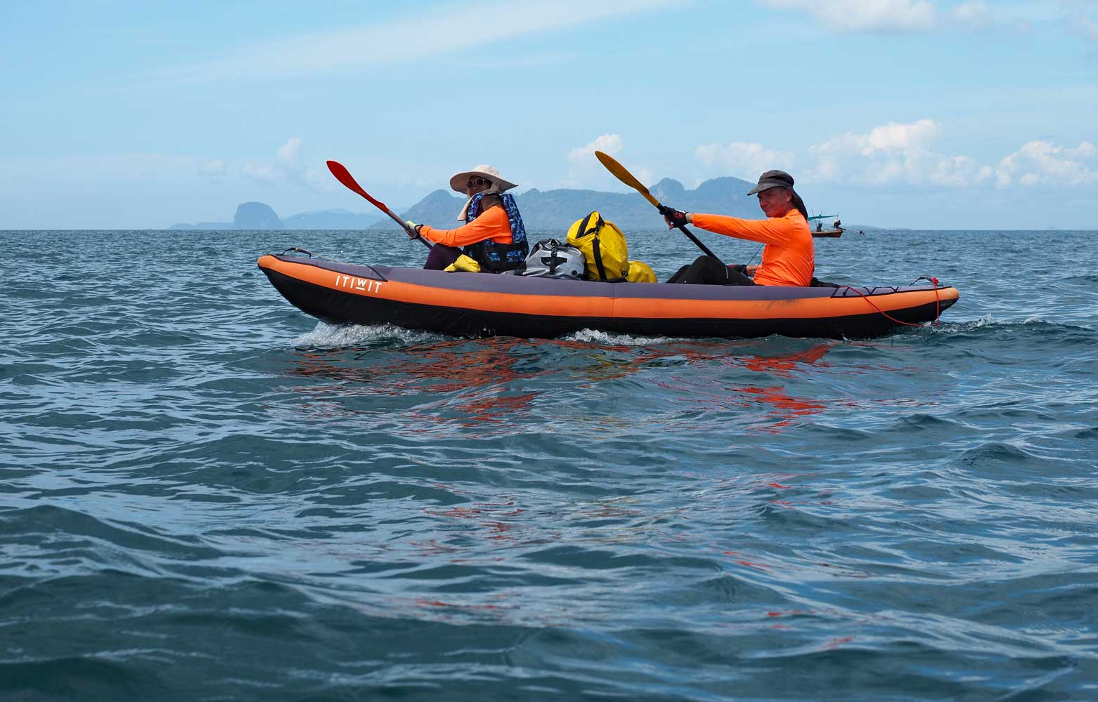
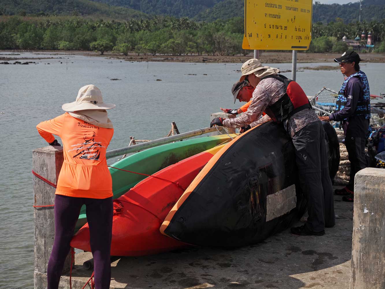
partly cloudy day with light breezes, we tied our gear atop the kayaks, then pushed
off from the beach. Chris had rigged all of the seats with backrests, which greatly
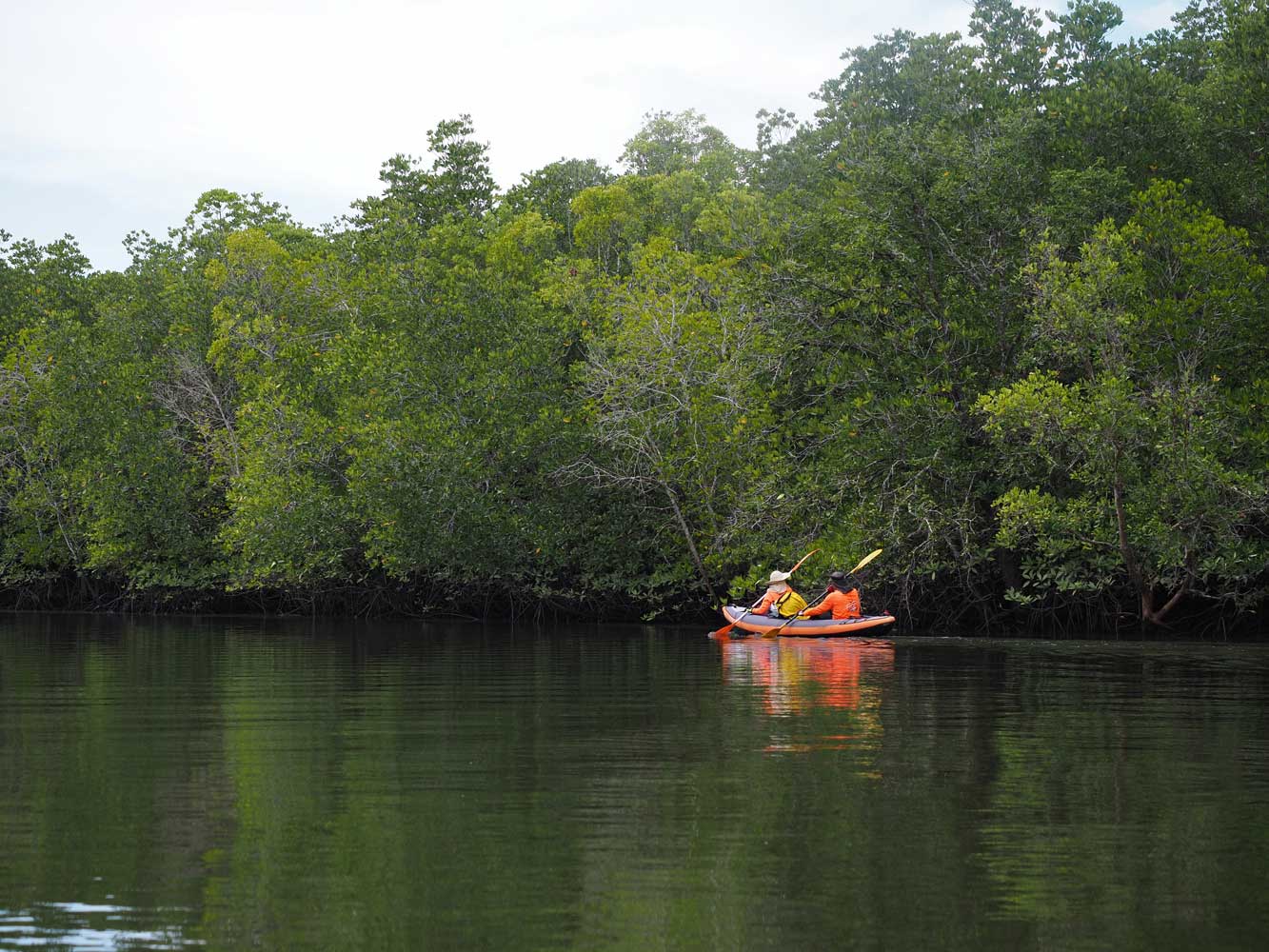
improved comfort. We had an inflatable kayakŚmore stable but slowerŚand two sit-on-top
polyethylene kayaks. We paddled with different companions during the trip.
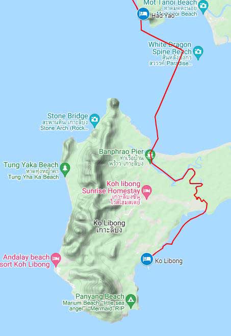
Day 1: Had Yao
Beach to Ko Libong
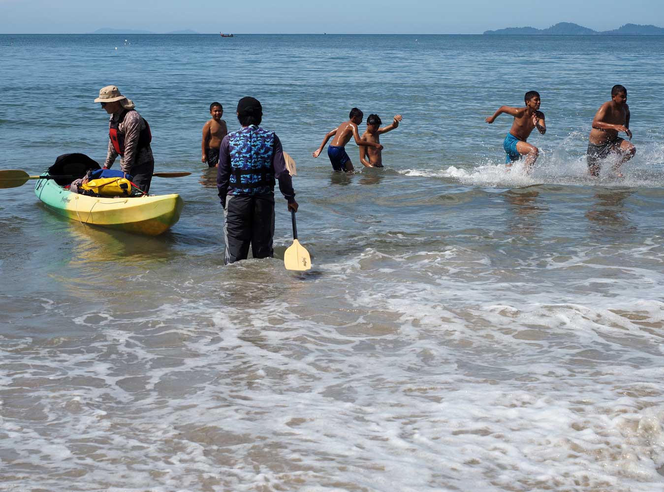
Kids play at Had
Yao Beach as Ian and Chow prepare their kayak.
A lovely morning
for the beginning of our journey
The kayaking began with paddling 2.3 kilometers southeast to White Dragon Spine
Beach, a long sandbar well off the mainland, and we stopped for a break on a bit
of island that rises above the water. Next we turned south for a 3.6-kilometer crossing
to Ko Libong (Ko means island in Thai) where we turned up a channel. In 0.8 kilometer
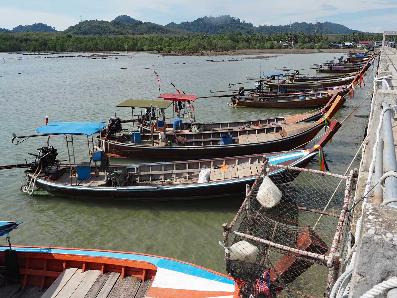
we passed the village Ban Phrao, the main port on the island, where wooden boats
shuttle back and forth between here and Had Yao Pier. Some of the boats carried
motorbikes, which gave me the idea of coming here another time with my bicycle.
A bit farther along we pulled into the shade of mangroves for our packed lunch.
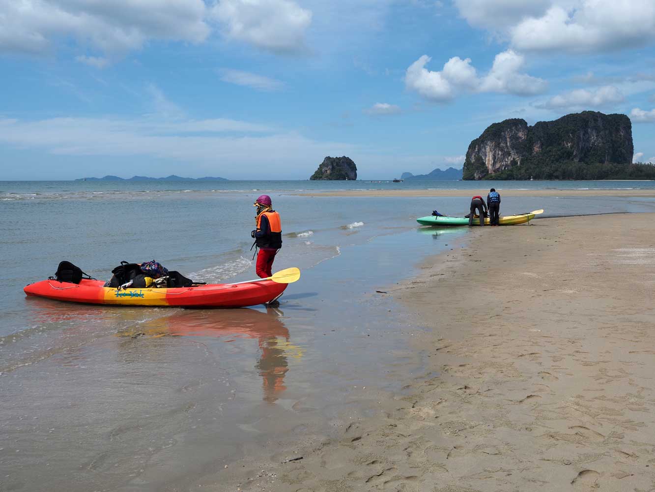
We venture out,
leaving the limestone pinnacles of the Had Yao Beach area behind.
Areeya and Chris
have a well-practiced kayaking style!
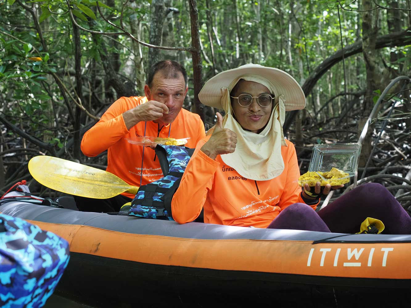
We pull into the
mangroves to enjoy our lunch.
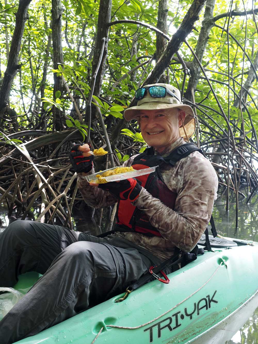
Ian dines amid the
greenery.
After lunch
we continued inland along the winding, tidal channel through mangroves for about
5 kilometers. Luckily the tide was high enough to easily exit the very shallow end
of the channel into the sea on the southeast coast. Lastly we paddled southwest
along the coast for 3 kilometers to Ban Batubute. We pulled in at Ban Batubute Pier,
carried kayaks and gear up onto it, then climbed the five-story towerŚbuilt for
dugong spottingŚat pierĺs end for views, though we didnĺt spot any dugongs. During
the outgoing tide we heard popping noises coming from the mud flats, likely caused
by small crabs.
We continue through
the channel in the mangroves.
We have completed
the hard work of bringing kayaks and gear onto Ban Batubute Pier.
Fishing boats tie
up before the tide goes out.
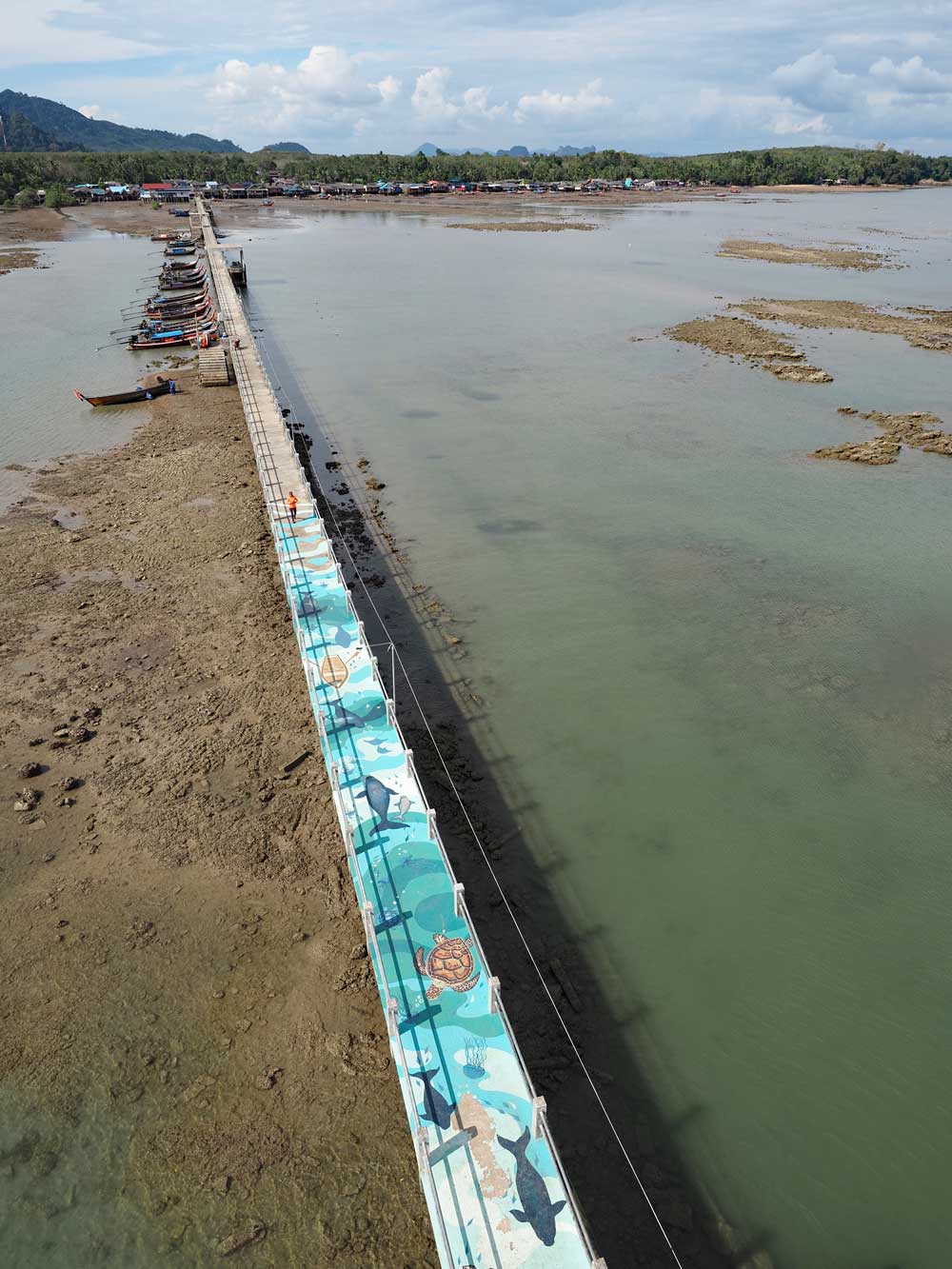
Ban Batubute Pier
and village at low tide, from the five-story tower
A short walk through the village brought us to Rim
Lay Homestay, where we had rented the entire house for our two-night stay. From
the veranda at the back we had a view of the shore which changed greatly between
low and high tide. In the evening we headed to Roti Ban Bang Air for dinner. I went
with mixed vegetables with red peppers, an omelet, rice, and a lime soda, followed
by a sweet banana roti.